Skip to content
Over the Clouds

Over the Clouds

El plaer de recórrer valls, carenes i assolir cims

  • Cyclability
    • 🚲<80%
    • 🚲 80-90%
    • 🚲 90-95%
    • 🚲 95-99%
    • 🚲 100%
  • Difficulty
    • Green (Easy)
    • Blue (intermediate)
    • Red (difficult)
    • Black (very difficult)
  • Geography
    • Catalan Pyrenees
    • French Pyrenees
    • The Andorran Pyrenees
    • Pre-Pyrenees
    • Inland Catalonia
    • Other
  • Maximum elevation
    • ⛰<1500m
    • ⛰ 1501-2500m
    • ⛰ > 2501m
  • About Us
  • English
    • Català
    • English
    • Español
    • Français

Category: Maximum elevation

Routes for maximum height
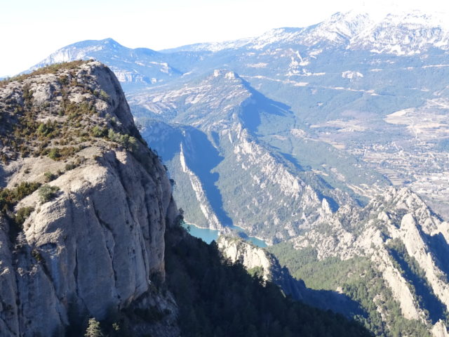
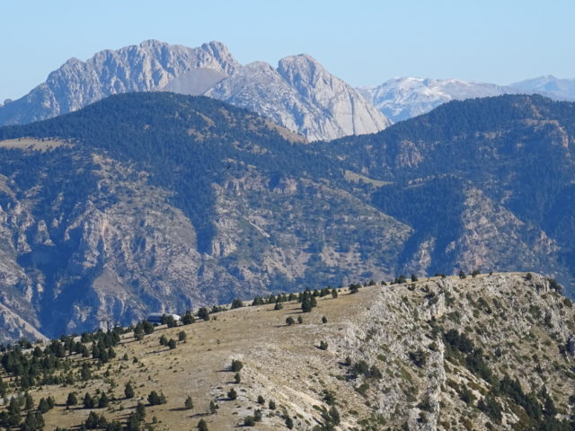
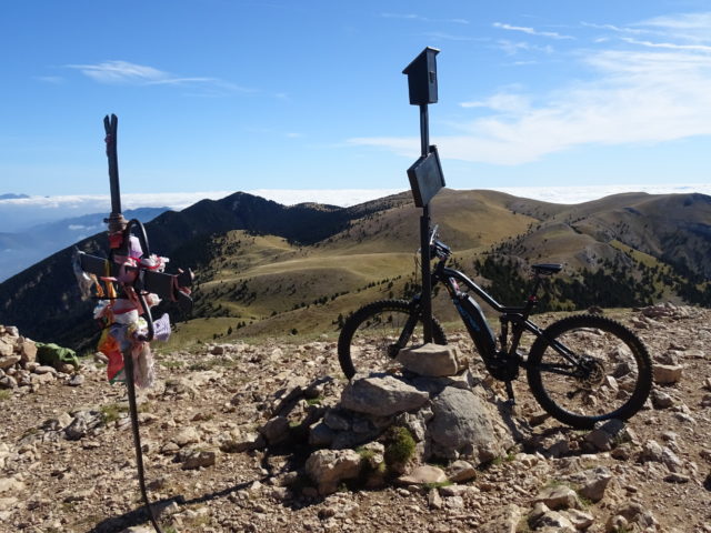
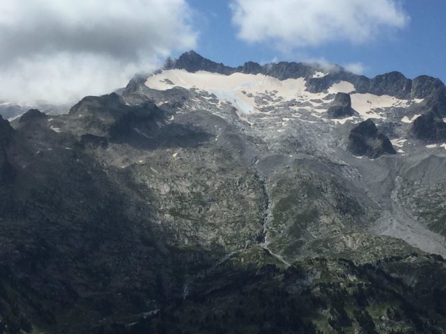
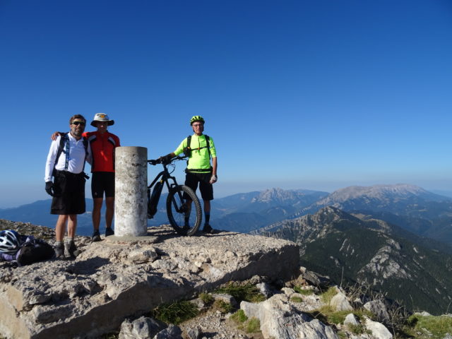
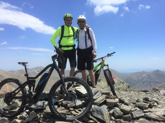
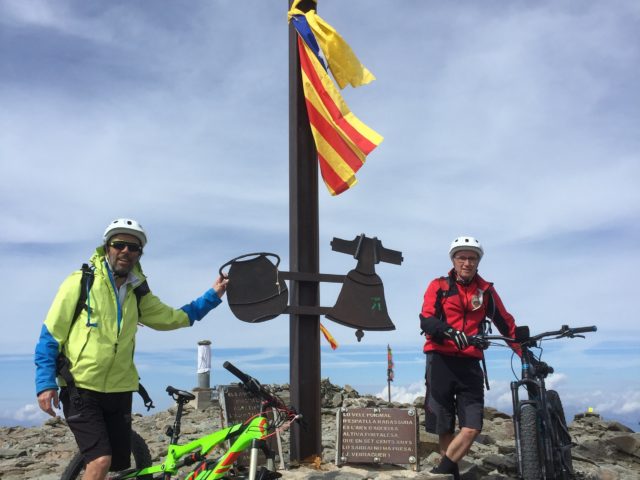
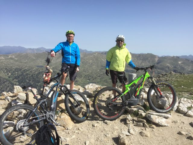
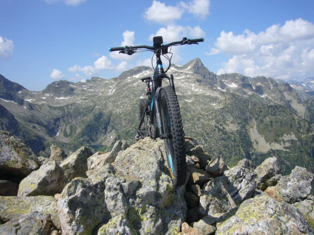
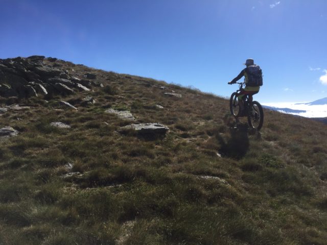
Categories ⛰ 1501-2500m Red (difficult) 🚲 90-95%
El Cogul i la Llebre (Serra de Busa)

El Cogul i la Llebre (Serra de Busa)

Posted on Posted on15 April, 2020By Jaume

Maximum height of the route: 1,526 meters Brief description: Discover the Serra de Busa following its most emblematic places and climb up to the two highest peaks of the mountain range. Large panoramic views on all sides due to the … TOTA LA RUTA AQUÍEl Cogul i la Llebre (Serra de Busa)

Categories ⛰ 1501-2500m Blue (intermediate) Pre-Pyrenees 🚲 100%
Puig de les Morreres (Port del Comte)

Puig de les Morreres (Port del Comte)

Posted on Posted on14 April, 202024 April, 2020By Jaume

Maximum height of the route: 2,211 meters Brief description: Climb to one of the peaks of the mountain range of Port del Comte from Coll de Jou. It is a fairly affordable route with large panoramas. Geographical area: Valley of … TOTA LA RUTA AQUÍPuig de les Morreres (Port del Comte)

Categories ⛰ 1501-2500m Black (very difficult) 🚲 80-90%
Cap de la Gallina Pelada (Serra d’Ensija)

Cap de la Gallina Pelada (Serra d’Ensija)

Posted on Posted on14 April, 2020By Jaume

Maximum height of the route: 2,317 meters Brief description: Climb to the culminating summit of the Serra D'ensija from the Font Freda. The first stretch of climb is very difficult but once in the area of meadows is a delight. … TOTA LA RUTA AQUÍCap de la Gallina Pelada (Serra d’Ensija)

Categories ⛰ 1501-2500m Red (difficult) 🚲 95-99%
Pòrt dera Picada i Port de Benás

Pòrt dera Picada i Port de Benás

Posted on Posted on13 April, 202024 April, 2020By Jaume

Maximum height of the route: 2,477 meters Brief description: Circular route between the Val D'aran and the valley of Benás raising the important ports dera Picada (2477 M.) and Benás (2445). Large panoramic views over the Maladeta mountain range. Highlight … TOTA LA RUTA AQUÍPòrt dera Picada i Port de Benás

Categories ⛰ > 2501m Red (difficult) 🚲 95-99%
Tosa d’Alp i Puigllançada

Tosa d’Alp i Puigllançada

Posted on Posted on13 April, 202026 April, 2020By Jaume

Maximum height of the route: 2,537 meters Brief description: Climb to the peaks of Tosa D’alp and puiglaunched from the ski resort of La Molina. The hardest stretch is the climb from Coll de Pal to puiglaunched. Large panoramic views … TOTA LA RUTA AQUÍTosa d’Alp i Puigllançada

Categories ⛰ > 2501m Red (difficult) 🚲 95-99%
Pic de la Fossa del Gegant (Vallter-Núria)

Pic de la Fossa del Gegant (Vallter-Núria)

Posted on Posted on13 April, 202024 April, 2020By Jaume

Maximum height of the route: 2,808 meters Brief description: It crosses from Vallter to Queralbs and through Nuria and reaching the top of La Fossa del Gegant, next to the Coll de Noucreus. Geographical area: Ripollès Cyclability Difficulty: Red Route … TOTA LA RUTA AQUÍPic de la Fossa del Gegant (Vallter-Núria)

Categories ⛰ > 2501m Black (very difficult) 🚲 95-99%
Puigmal des d’Err

Puigmal des d’Err

Posted on Posted on13 April, 2020By Jaume

Maximum height of the route: 2,911 meters Brief description: Climb to the summit of Puigmal making a circular route from the town of Err. It goes up the old ski slopes of Puigmal 2600 and it is returned by the … TOTA LA RUTA AQUÍPuigmal des d’Err

Categories ⛰ > 2501m Catalan Pyrenees Red (difficult) 🚲 90-95%
Tossa Plana de Lles-Port de Vallcivera

Tossa Plana de Lles-Port de Vallcivera

Posted on Posted on12 April, 2020By Jaume

Maximum height of the route: 2,905 meters Brief description: Climb to one of the roofs of La Cerdanya from the shelter of Cap de Rec and return by Vallcivera and the Llosa Valley. Geographical area: Pyrenees Cyclability Difficulty: Red Route … TOTA LA RUTA AQUÍTossa Plana de Lles-Port de Vallcivera

Categories ⛰ 1501-2500m Black (very difficult) 🚲 80-90%
Tuc de Salana – Montcasau – Prüedo

Tuc de Salana – Montcasau – Prüedo

Posted on Posted on12 April, 2020By Jaume

Maximum height of the route: 2,486 meters Brief description: Short but intense high mountain route through the peripheral area of the Aigüestortes National Park with the difficult ascent to Tuc de Salana. Geographical area: Pyrenees Cyclability Difficulty: Black Route Briefing … TOTA LA RUTA AQUÍTuc de Salana – Montcasau – Prüedo

Categories ⛰ > 2501m Blue (intermediate) 🚲 95-99%
Pic de Mortiers

Pic de Mortiers

Posted on Posted on12 April, 2020By Joan

Maximum height of the route: 2,605 meters Brief description: Classic high mountain bike route. Great panoramic views. Geographical area: Capcir Cyclability Difficulty: Blue Route Briefing Video of the route Download the track of the route Image gallery

Posts navigation

Previous Page 1 … Page 5 Page 6 Page 7 Next
  • YOUTUBE
Copyright © 2025 Over the Clouds | Travelore by Catch Themes
Scroll Up